File:Aqua virgo planlatium.jpg
Jump to navigation
Jump to search
Size of this preview: 781 × 600 pixels. Other resolutions: 313 × 240 pixels | 625 × 480 pixels | 1,000 × 768 pixels | 1,280 × 983 pixels | 2,560 × 1,965 pixels | 2,734 × 2,099 pixels.
Original file (2,734 × 2,099 pixels, file size: 2.64 MB, MIME type: image/jpeg)
Captions
Captions
Add a one-line explanation of what this file represents
Summary[edit]
| Description |
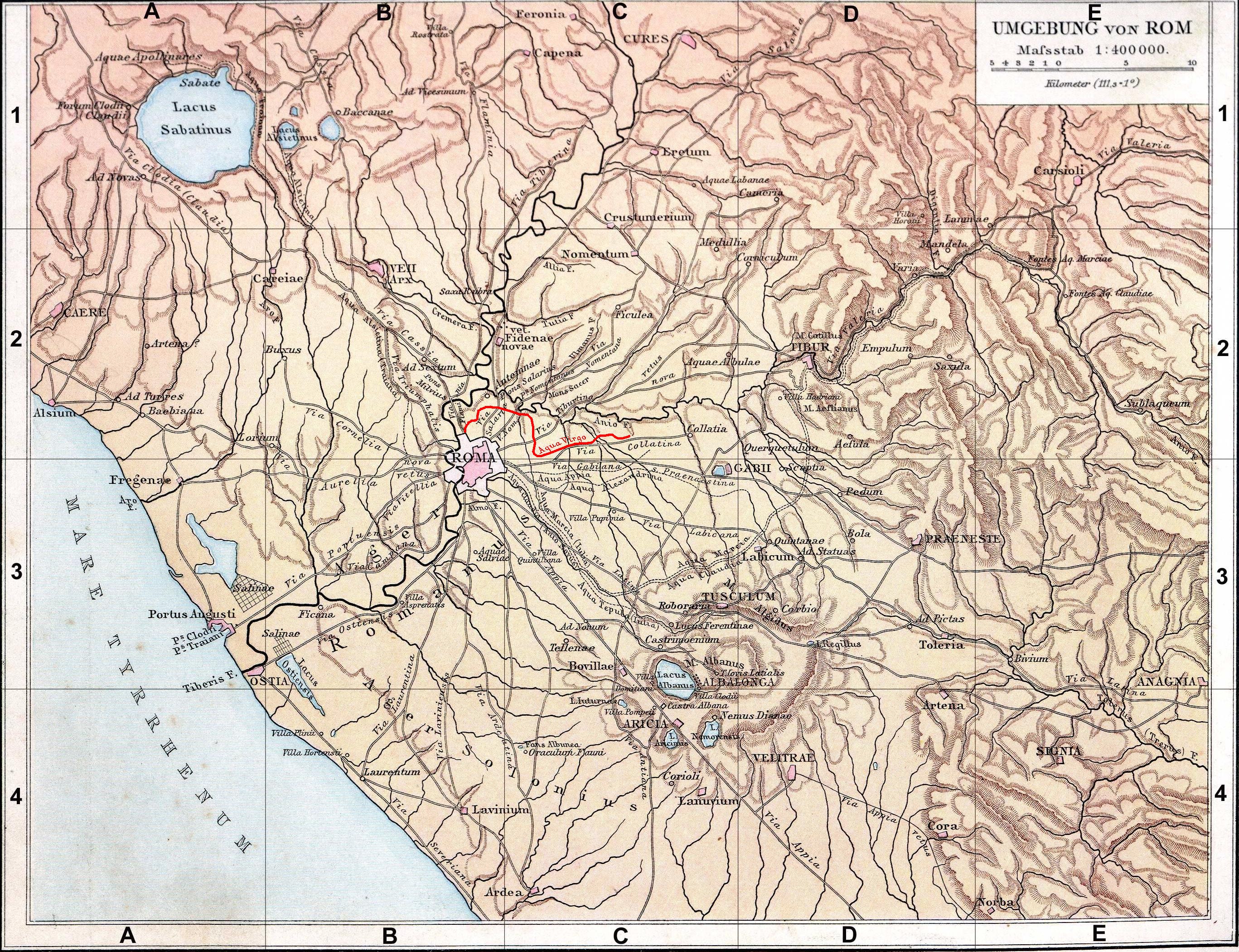
Français : Fond de carte de 1886, libre de droit (Image:Rom_Umgebung.jpg), avec fr:l'aqua appia en rouge.
|
| Date | / 2008 |
| Source | G. Droysens Allgemeiner Historischer Handatlas / own work |
| Author | ? / Coldeel |
| Other versions |
 |
Licensing[edit]
| I, the copyright holder of this work, release this work into the public domain. This applies worldwide. In some countries this may not be legally possible; if so: I grant anyone the right to use this work for any purpose, without any conditions, unless such conditions are required by law. |
File history
Click on a date/time to view the file as it appeared at that time.
| Date/Time | Thumbnail | Dimensions | User | Comment | |
|---|---|---|---|---|---|
| current | 12:42, 9 June 2008 | | 2,734 × 2,099 (2.64 MB) | Coldeel (talk | contribs) | {{Information |Description={{fr|1=Fond de carte de 1886 (G. Droysens Allgemeiner Historischer Handatlas), libre de droit (Image:Rom_Umgebung.jpg), avec l'aqua appia en rouge.}} |Source=Fond de carte 1886 / travail personnel (own work) |Author=? / [[U |
You cannot overwrite this file.
File usage on Commons
The following page uses this file:
File usage on other wikis
The following other wikis use this file:
- Usage on de.wikipedia.org
- Usage on la.wikipedia.org
- Usage on uk.wikipedia.org